








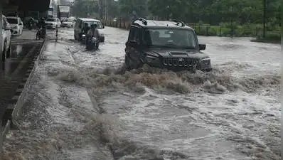
Gurgaon: A drone survey will soon map Gurgaon’s terrain to help identify an alternative route for carrying excess rainwater out of the city, a move aimed at reducing monsoon flooding and creating water storage for irrigation in neighbouring districts.The proposed stormwater drainage project seeks to divert surplus runoff to the Yamuna via Nuh and Palwal, easing the load on Delhi’s Najafgarh drain, which currently carries nearly all of Gurgaon’s runoff.The survey will also identify four to five large detention ponds beyond Sohna to store monsoon water for irrigation in Gurgaon, Nuh, Faridabad and Palwal during the dry season.A consultant was engaged for the project in June. Ground surveys and collection of topographical and hydrological data are underway, while permissions have been sought from various departments for the drone survey. A preliminary report is expected by Oct, officials said.The survey will use high-resolution aerial mapping to capture the city’s terrain, natural slopes, existing drains, water channels, low-lying areas and built-up regions. Combined with ground survey data, this will help planners prepare a digital elevation model to identify the most suitable alignment for the proposed drainage channel, locate areas where rainwater accumulates naturally, assess the feasibility of detention ponds, and estimate the carrying capacity needed for the new network. Officials said the aerial data will also verify field survey findings before the feasibility report is finalised.“We have sought permission from the departments concerned for carrying out the drone survey. The consultant has already started the ground survey and data collection. Once the feasibility report is submitted and approved, the project estimate will be prepared,” a GMDA official said.The Najafgarh drain is currently the only major drainage basin for Gurgaon, and officials said it is under growing pressure from rapid urbanisation. Open fields, natural drains and low-lying areas that once absorbed rainwater have gradually given way to roads, buildings and paved surfaces, sharply increasing surface runoff during heavy rain.According to GMDA, a natural elevation difference of 70-78 metres between the Aravali foothills and the Najafgarh drain causes rainwater to flow rapidly towards the drain during intense rainfall, raising the risk of overflow. The drain, which originates at the Dhansa regulator and joins the Yamuna after passing through Haryana and Delhi, also receives stormwater from Jhajjar district through outfall drain No. 8. Though it has a carrying capacity of around 10,000 cusecs, monsoon inflows often reach 12,000-13,000 cusecs.Stormwater from the city currently enters the Najafgarh drain through three major inlet channels. Under the concept being examined, stormwater from Gurgaon’s north-eastern and Aravali catchments — including Ghata, Gwal Pahari, Golf Course Road, Vatika Chowk, Subhash Chowk and sectors along the Gurgaon-Sohna highway — will be diverted towards Bhondsi, from where a new open or underground drain would carry the flow into the Nuh drainage system before it joins the Yamuna basin. The channel will pass through villages in Gurgaon and Nuh districts, carrying runoff from both urban and rural catchments, including the Aravali foothills.The project is being executed jointly by GMDA and the irrigation and water resources department, under the supervision of the state mission directorate headed by the chief secretary.