








Jaipur: Motorists approaching 101 accident-prone stretches on highways across the Jaipur Range may soon receive advance safety alerts through Google Maps, under a police initiative that uses three years of accident and fatality data to identify and digitally map high-risk locations.Jaipur Range police has used geospatial mapping to analyse accident records from 2023 to 2025 and pinpoint stretches where crashes and fatalities were repeatedly reported. The geographical coordinates of these locations were then verified and shared with Google for technical integration with its navigation platform.
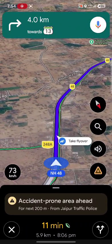
Screenshots showing accident hotspot alerts integrated into Google Maps for commuters travelling across Jaipur Range districts
Jaipur Range IG Rahul Prakash said motorists using Google Maps navigation on selected highways in the range’s eight districts would receive a road-safety alert as they approached an identified high-risk stretch. The initiative, he said, is aimed at giving drivers “time to slow down and exercise greater caution” before reaching a dangerous location.The 101 identified spots are spread across eight districts — 28 in Jaipur Rural, 24 in Dausa, 19 in Kotputli-Behror, 11 in Alwar, 10 in Sikar, five in Bhiwadi, three in Khairthal-Tijara and one in Jhunjhunu.Rather than classifying the locations solely on the basis of the number of accidents, police primarily assessed the severity of fatalities recorded over the three-year period. The sites were subsequently divided into three risk categories.Six locations where more than 20 fatalities were recorded have been classified as Category A, or high-risk zones, and marked red on the digital map. Thirty-two locations with 10 to 20 fatalities fall under Category B, or medium-risk zones, and are marked orange. The remaining 63 locations, where more than five but fewer than 10 fatalities were recorded, have been placed in Category C and marked yellow.The range has also developed a QR-code-based public access system. Scanning the code opens a Google Maps view displaying all 101 accident-prone stretches along with their risk classification and other road-safety information.Officials said the initiative is intended to move road safety beyond enforcement and post-accident response by using existing police data for preventive intervention. “The idea is to give drivers time to slow down and exercise greater caution,” Prakash said.The project combines accident records, data analysis and geospatial mapping to identify where the risk to motorists is greatest and issue warnings before they enter such stretches. Police said the initiative could provide a technology-based model for preventive road-safety measures beyond the Jaipur Range.