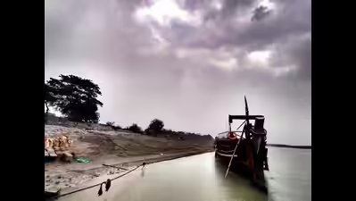

Guwahati: A new multi-proxy palaeoecological study of sediments from Majuli river island has reconstructed the last 4,000 years of its climate, vegetation, and flood history.Majuli, the world’s largest inhabited river island, is also culturally significant as a settlement for several tribes and as a major centre of Assam’s neo-Vaishnavite culture, a reformist Vaishnavism movement.The findings reveal five distinct phases of ecological change, showing how forests, monsoons, and human activity shaped the world’s largest inhabited river island and how its past resilience offers lessons for today’s flood affected communities.Scientists from the Birbal Sahni Institute of Palaeosciences (BSIP), Lucknow, an autonomous institute of the department of science and technology (DST), carried out this pioneering palaeoecological study on the island, which has witnessed severe land loss and is highly vulnerable to deforestation, urbanisation, and recurrent flooding.The scientists analysed fossil pollen and sediment from the Sakali wetland on the island to track vegetation and river dynamics. Pollen serves as one of the most reliable indicators of past environmental conditions, as it is durable and can remain preserved in sediments for thousands to millions of years.“The study offers a long-term perspective on climate variability, vegetation change, and flood dynamics on Majuli Island and could shape adaptation strategies for flood-affected communities,” the ministry of science and technology said.The study notes that Majuli, lying about 25.75 m above sea level in the Brahmaputra River and spanning nearly 92,460 hectares, is unique in its origin in the sense that, unlike typical sandbars, it is a fragment of the mainland that transformed into an island in the 16th century, following a major fluvial reorganisation when the Brahmaputra shifted its course from north to south.This geomorphological shift carved Majuli into its present form, bordered by the Kherkutia Suti, Subansiri, and the Brahmaputra. Over time, the island developed a mosaic of more than 70 wetlands, including Sakali, Garamur, and Pharam, which expand and recede seasonally.“However, deforestation, urbanisation, and frequent floods threaten its fragile ecosystems,” the report reads.The ministry said, despite its acquiring Unesco’s tentative status for cultural significance, the region lacked any comprehensive long-term palaeoecological reconstruction based on palynological evidence resting on integrated modern and fossil pollen records.The study reconstructed mid-late Holocene environmental changes, filling a critical gap in understanding regional climate, vegetation, and wetland dynamics in the upper Brahmaputra Valley. The results indicate an early warm and humid phase during 4040–2260 calibrated years before present (cal yrs BP) with dense forest cover, suggesting resilience during the 4.2 ka dry climatic event (4200 years ago).This was followed by phases of fluctuating monsoon intensity and flood regimes, including a relatively moist period during 1100–500 cal. yrs. BP., corresponding to the medieval climatic anomaly. The last around 500 years show declining temperatures and precipitation, consistent with the Little Ice Age, along with increased anthropogenic influence and expansion of scattered vegetation.The ministry stated that the “results demonstrate clear synchronicity between local vegetation dynamics and major global climatic events, highlighting the sensitivity of the region to broader climate forcing. The findings also identify phases of ecological resilience and vulnerability, providing a scientific basis for biodiversity conservation, wetland restoration, and sustainable land-use planning.”Published in Review of Palaeobotany and Palynology (Elsevier), this study was led by Arya Pandey (DST-INSPIRE SRF) and Dr. Swati Tripathi of Birbal Sahni Institute of Palaeosciences (BSIP), in collaboration with Dr. Sadhan Kumar Basumatary (BSIP), Dr. Salman Khan (Germany) Dr. Hema Singh (BHU), Dr. Biswajeet Thakur (BSIP), and Dr. Anupam Sharma (BSIP) .